


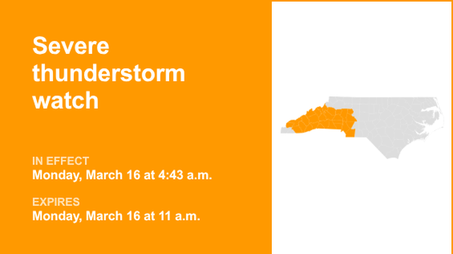
Communities across the Carolinas were placed under a Severe Thunderstorm Watch as a powerful line of storms moved through the region, bringing the threat of damaging winds, heavy rain, and possible tornadoes. Meteorologists warned residents to remain alert as the system tracked east across North and South Carolina throughout the day.
According to forecasters from Severe Weather Center 9, the storm system could produce strong wind gusts capable of downing trees and power lines, along with periods of intense rainfall and lightning. Meteorologists also warned that isolated tornadoes could develop, especially as the storm line strengthens during peak daytime heating.
The storms are part of a larger severe weather outbreak affecting much of the eastern United States, with atmospheric conditions favorable for rotating storms and powerful wind shear capable of producing tornadoes. The main hazards across the Carolinas include wind gusts potentially exceeding 60–70 mph, brief tornado spin-ups, and localized flooding from heavy downpours.
The severe weather has already caused disruptions across the region. Flights at Charlotte Douglas International Airportexperienced cancellations and delays as thunderstorms moved through the area, prompting a temporary ground stop earlier in the day.
Emergency officials are urging residents to closely monitor weather alerts and be prepared to take shelter if warnings are issued. Experts remind the public that a tornado watch means conditions are favorable for tornadoes, while a tornado warning means one has been spotted or detected on radar and immediate shelter is necessary.
Forecasters say conditions will continue to evolve as the storm system moves through the Southeast, and residents across the Carolinas are encouraged to stay weather-aware and prepared for rapidly changing conditions.


No comments